
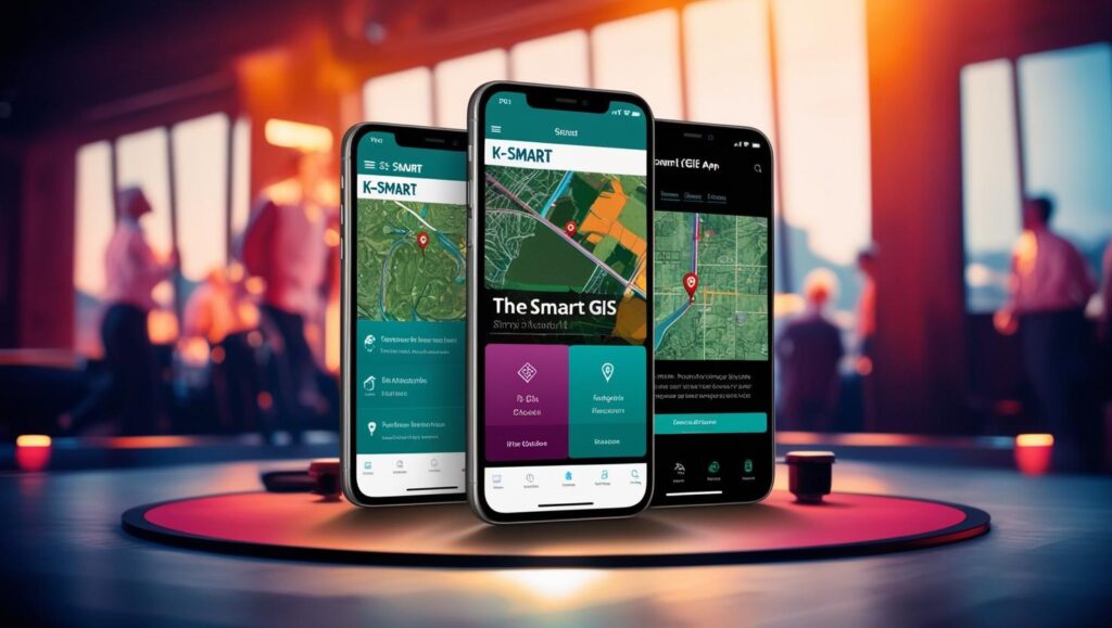
Introduction to K-SMART GIS Mobile Application
The Government of Kerala has taken a significant leap in digital governance with the launch of the K-SMART GIS mobile application, available for download on the Google Play Store at play.google.com/store/apps/details?id=in.gov.ikm.gis. This innovative app represents a mobile extension of Kerala’s comprehensive e-governance platform, bringing the convenience of municipal services directly to citizens’ smartphones. Designed to complement the web portal (ksmart.lsgkerala.gov.in), the K-SMART GIS app integrates Geographic Information System (GIS) technology with civic service delivery, creating a powerful tool for both citizens and local government officials. With over 100,000 downloads and a 4+ star rating, the application has become an essential utility for Keralites seeking efficient access to government services. This 1000-word guide explores every aspect of the K-SMART GIS app, from its core features and installation process to advanced functionalities and troubleshooting tips.
Key Features and Benefits of K-SMART GIS App
The K-SMART GIS mobile application offers a robust set of features that transform how citizens interact with local government services:
1. Comprehensive Service Access
The app provides mobile access to all services available on the K-SMART web portal, including birth/death/marriage certificate applications, property tax payments, building permit requests, and various license applications. Users can initiate, track, and complete entire service workflows without visiting government offices.
2. GIS-Enabled Location Services
The integration of Geographic Information System technology allows users to visualize property boundaries, municipal zones, and infrastructure projects on interactive maps. This feature proves particularly valuable for property owners, urban planners, and businesses requiring spatial information about their localities.
3. Real-Time Application Tracking
Citizens can monitor the status of all submitted applications through a centralized dashboard, receiving push notifications at each processing stage. This transparency eliminates uncertainty about application progress and expected completion times.
4. Document Management System
The app includes a secure digital wallet for storing and accessing important documents like property deeds, certificates, and payment receipts. Users can quickly retrieve these documents when needed without carrying physical copies.
5. Multi-Language Support
Available in Malayalam and English, the app ensures accessibility for all demographic groups across Kerala. The interface adapts seamlessly to either language preference.
6. Secure Payment Gateway
Integrated payment options allow users to pay taxes, fees, and penalties directly through the app using UPI, net banking, or credit/debit cards, with instant receipt generation.
7. Grievance Redressal System
A dedicated complaint registration feature enables citizens to report civic issues like road repairs, waste management problems, or street light outages with geotagged photos for precise location identification.
Step-by-Step Installation and Setup Guide
1. Downloading the Application
The K-SMART GIS app is currently available for Android devices through the Google Play Store. To install:
- Open Google Play Store on your Android smartphone
- Search for “K-SMART GIS” or visit the direct link: play.google.com/store/apps/details?id=in.gov.ikm.gis
- Tap “Install” and wait for the 25MB download to complete
- The app requires Android 8.0 or higher for optimal performance
2. Initial Setup and Registration
Upon first launch, users must complete a one-time registration process:
- Open the app and select “New User Registration”
- Provide basic details including name, mobile number, and email address
- Verify your mobile number through OTP authentication
- Create a strong password following the app’s security requirements
- Complete profile setup by adding address details and local body information
3. Account Verification
For full access to all services, users should complete KYC verification:
- Upload a scanned copy of your Aadhaar card
- Provide additional identity proof if required
- Verification typically completes within 24-48 hours
4. Personalizing Your Dashboard
The app allows customization of the home screen for quick access to frequently used services:
- Pin preferred services to the top of your dashboard
- Set notification preferences for different service categories
- Configure language and display settings
Navigating the App Interface
The K-SMART GIS app features an intuitive user interface designed for efficient navigation:
1. Main Menu
Accessible via a hamburger icon, the main menu organizes services into logical categories:
- Certificates: All document-related services
- Payments: Tax and utility bill payments
- Licenses: Applications and renewals
- Complaints: Grievance registration and tracking
- Maps: GIS functionality and spatial data
2. Service Categories
Each main category contains subcategories with specific services:
- Under Certificates: Birth, Death, Marriage, Income, Residence
- Under Payments: Property Tax, Water Charges, Professional Tax
- Under Licenses: Building Permits, Trade Licenses, Vehicle Permits
3. Search Functionality
A powerful search tool helps users quickly locate specific services or information by keyword.
4. Quick Actions
Floating action buttons provide one-tap access to frequently performed tasks like new applications or payments.
Advanced GIS Functionalities
The app’s GIS capabilities offer unique advantages for various user groups:
1. Property Information System
- View precise boundaries of your property
- Access assessment details and tax history
- Check zoning regulations and land use patterns
2. Infrastructure Mapping
- Locate public utilities like water lines and electrical grids
- Identify government buildings and facilities
- View transportation networks and planned projects
3. Spatial Analysis Tools
- Measure distances between locations
- Calculate property areas
- Generate elevation profiles
4. Planning and Development
- Check development plans for specific areas
- View approved construction projects
- Access urban planning documents
Security Features and Data Protection
The K-SMART GIS app incorporates multiple security measures to protect user data:
1. Authentication Protocols
- Two-factor authentication options
- Biometric login support (fingerprint/face recognition)
- Session timeouts after periods of inactivity
2. Data Encryption
- End-to-end encryption for all communications
- Secure storage of sensitive documents
- Regular security audits and updates
3. Privacy Controls
- Granular permissions for location access
- Option to disable personalized tracking
- Clear data usage policies
Troubleshooting Common Issues
Despite its robust design, users may occasionally encounter technical challenges:
1. Installation Problems
- Ensure sufficient storage space (minimum 50MB recommended)
- Check Android version compatibility
- Enable installation from unknown sources if required
2. Login Difficulties
- Reset password if credentials are forgotten
- Verify mobile network connectivity for OTP reception
- Clear app cache if authentication fails repeatedly
3. Performance Issues
- Close background apps to free up memory
- Update to the latest app version
- Restart device if app becomes unresponsive
4. Feature-Specific Problems
- Enable location services for GIS functionality
- Allow camera access for document scanning
- Grant storage permissions for file downloads
Future Developments and Roadmap
The K-SMART development team continues to enhance the mobile application with planned upgrades:
1. iOS Version Release
- Development underway for Apple App Store availability
- Expected launch within the next fiscal year
2. Augmented Reality Features
- AR visualization of underground utilities
- 3D property mapping capabilities
3. Enhanced AI Integration
- Chatbot for instant query resolution
- Predictive services based on user behavior
4. Expanded Service Catalog
- Integration with more state government schemes
- Addition of welfare program applications
Conclusion: Transforming Civic Engagement Through Mobile Technology
The K-SMART GIS mobile application represents a paradigm shift in how citizens interact with local government in Kerala. By combining comprehensive service access with advanced GIS capabilities, the app delivers unprecedented convenience and transparency in municipal operations. Its continued development reflects Kerala’s commitment to leveraging digital technology for improved governance and citizen empowerment.
For residents of Kerala, downloading and mastering the K-SMART GIS app means joining the state’s digital governance revolution—a movement toward efficient, transparent, and accessible public services available anytime, anywhere. As the app evolves with new features and services, its role in daily civic life will only grow more significant, setting a benchmark for mobile governance solutions across India.


?")
